Category: Exploring Mars

Landslide in Valles Marineris

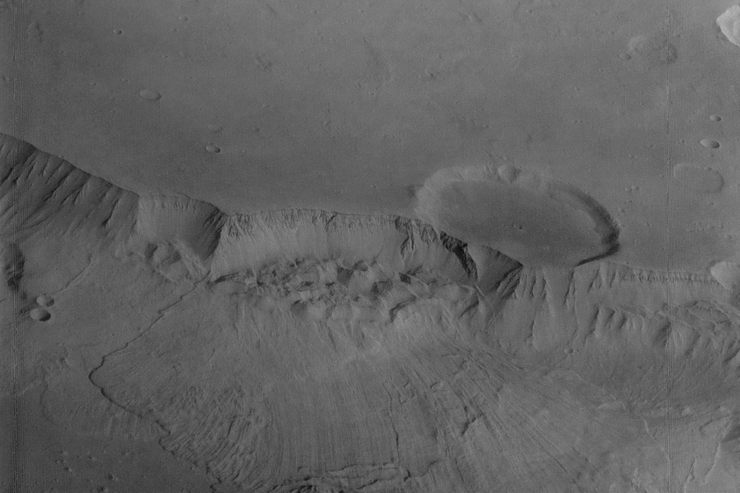
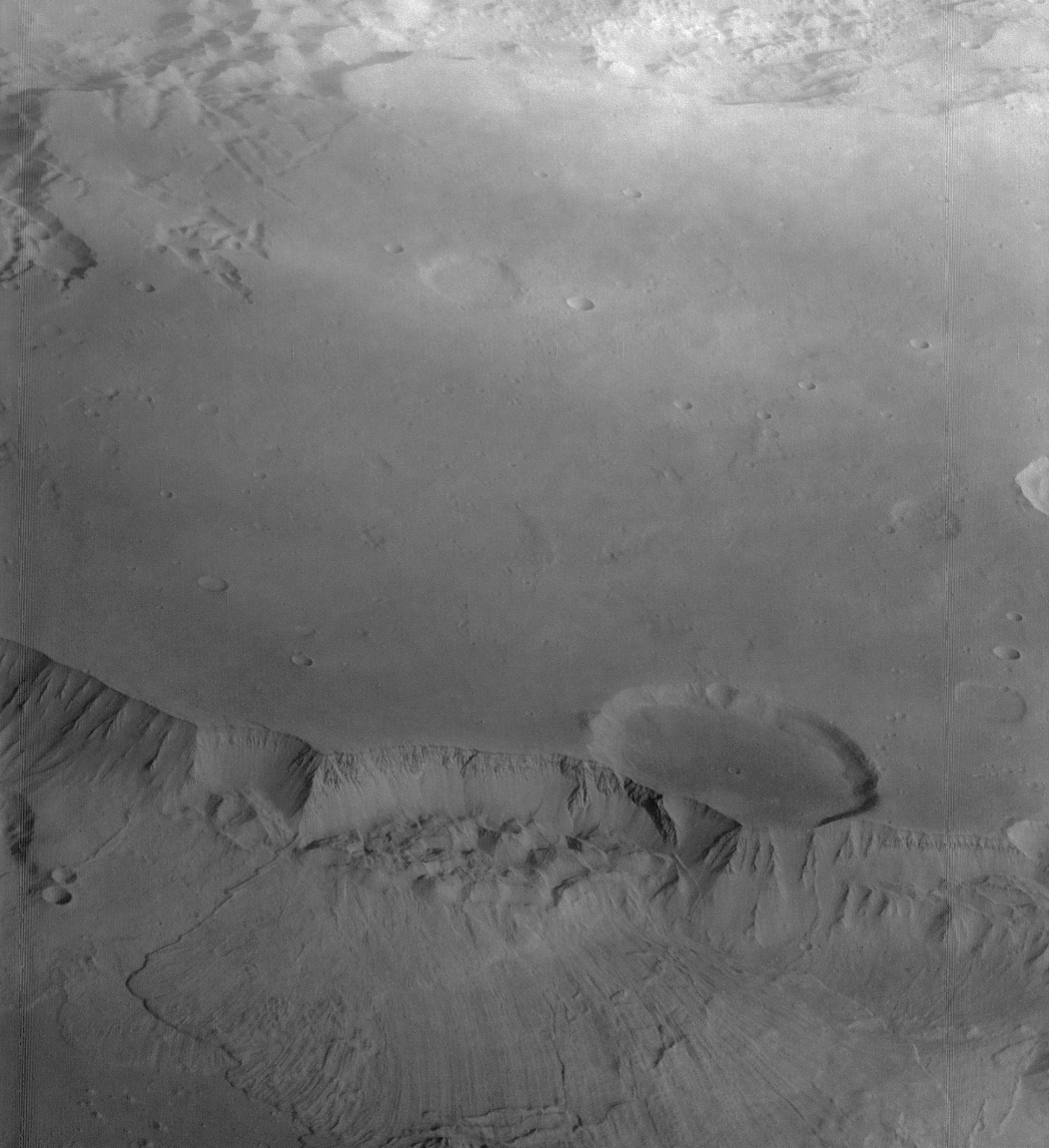
Although Valles Marineris originated as a tectonic structure, it has been modified by other processes. This image shows a close-up view of a landslide at the 5 km high south wall of Ganges Chasma.
The unnamed impact crater on the plateau, which is a part of Aurorae Planum, is approximately 27 km in diameter. The floor of the crater is smooth and flat, so it seems likely that the interior of this crater has been partly filled with basalts or with sand and dust blown by wind. The landslide partially removed the rim of the crater. The debris apron appears to have formed by collapse of the slump blocks at the base of the wall and extends about 40 kilometers across the floor of Ganges Chasma.
The landslides in Valles Marineris generally show few meteorite impact craters, and so are quite young; they probably formed in the Amazonian Epoch of Mars’ history, some 1.8 billion years ago.

Viking 1 Orbiter image f014a30, taken on July 4, 1976.
The image covers a length of approximately 60 kilometers.

(Image Credit: NASA/JPL/Arizona State University/astroarts.org)

High-resolution PNG (1050×1150 pixels; 597 KB)

Color mosaic of Olympus Mons

Mosaic of the Martian Olympus Mons volcano and its surrounding plains made from two color composites using the following Viking 1 Orbiter images:
f735a41 and f735a42 (violet), f735a45 and f735a46 (green), f735a47 and f735a48 (red). These images were taken on June 22, 1978.
The mosaic covers an area of nearly 1,600 x 800 kilometers. North is right and west is up.

(Image Credit: NASA/JPL/Arizona State University/Mosaic by astroarts.org)

High-resolution PNG (2115×945 pixels; 2.74 MB)

Video of Mars Express orbiting the Red Planet

This movie shows views of Mars as Mars Express loops between apoapsis (maximum height above the surface), at 10,527 km, to periapsis (lowest height), at just 358 km, and back again.
The giant volcanoes of Mars can be clearly seen at the start of the video, visible as a constellation of dark spots on the desert surface. They are followed by a glimpse of the icy South Pole before plunging into the darkness of the planet’s night side. Daylight returns with a soaring ride over the spiral ices of the Martian North Pole. At the very end, Phobos passes far beneath Mars Express, and the tiny moon’s disk can be seen as a dark circle moving from top to bottom.
The images used to generate this video, 600 in total, were acquired by the Visual Monitoring Camera (VMC) during the 8194th orbit on May 27, 2010, between 02:00 and 09:00 UTC. This is the first such video ever generated from a spacecraft orbiting Mars.
The VMC is a low-resolution, non-scientific digital camera originally used only to confirm the separation of the (later lost) Beagle 2 lander from Mars Express in 2003.

See also:
Astronaut’s eye view: Mars Express orbiting the Red Planet

Olympus Mons caldera

This mosaic of 22 Viking 1 Orbiter images (f473s13/17/19/21/23/25/27/29, f474s17/19, and f474s21 to 32), taken on July 11 and July 12, 1980, shows the complex caldera at the summit of Olympus Mons. South is at the top.
The caldera, a composite of as many as seven roughly circular collapse depressions, is 66 by 83 km across. The lowest parts of the floor are over 4 kilometers below the rim of the caldera.

(Image Credit: NASA/JPL/Arizona State University/Mosaic by astroarts.org)

High-resolution PNG (4475×4610 pixels; 6.38 MB)

Note: This is the most complete high-resolution Viking Orbiter image mosaic of the Olympus Mons caldera which has been published to date.
For comparison, here is a mosaic of the Olympus Mons caldera produced by A. Tayfun Öner in 1997 and published on Calvin J. Hamilton’s website “Views of the Solar System”, and here is a mosaic produced by JPL and published in NASA’s Planetary Photojournal.

Ascraeus Mons caldera

Ascraeus Mons is the northernmost of three shield volcanoes (known as the Tharsis Montes) near the equator of Mars. Its complex caldera (volcanic crater) is composed of several discrete centers of collapse, where the older collapse features are cross-cut by more recent collapse events. The lowermost circular floor preserves the last lava flooding event that followed the last major collapse approximately 100 million years ago. The southern wall of the caldera has at least 3 km of vertical relief with an average slope of at least 26 degrees (from horizontal). The caldera complex truncates several lava flows, indicating that the flows predate the collapse event and that their source areas have been destroyed by the caldera formation.

References:
G. Neukum et al.: Recent and episodic volcanic and glacial activity on Mars revealed by the HRSC (853 KB)

The image was taken on January 31, 2004, by the High Resolution Stereo Camera (HRSC) on board ESA’s Mars Express spacecraft.
Color composite of the infrared, green and blue channels of the HRSC, adapted to a Mars-like appearance.
The image resolution is 15 m per pixel. North is up.

(Image Credit: ESA/DLR/FU Berlin/astroarts.org)

High-resolution JPEG (4130×3880 pixels; 2.12 MB)